Winter weather watch worsens to warning
Published 5:20 am Friday, April 13, 2018
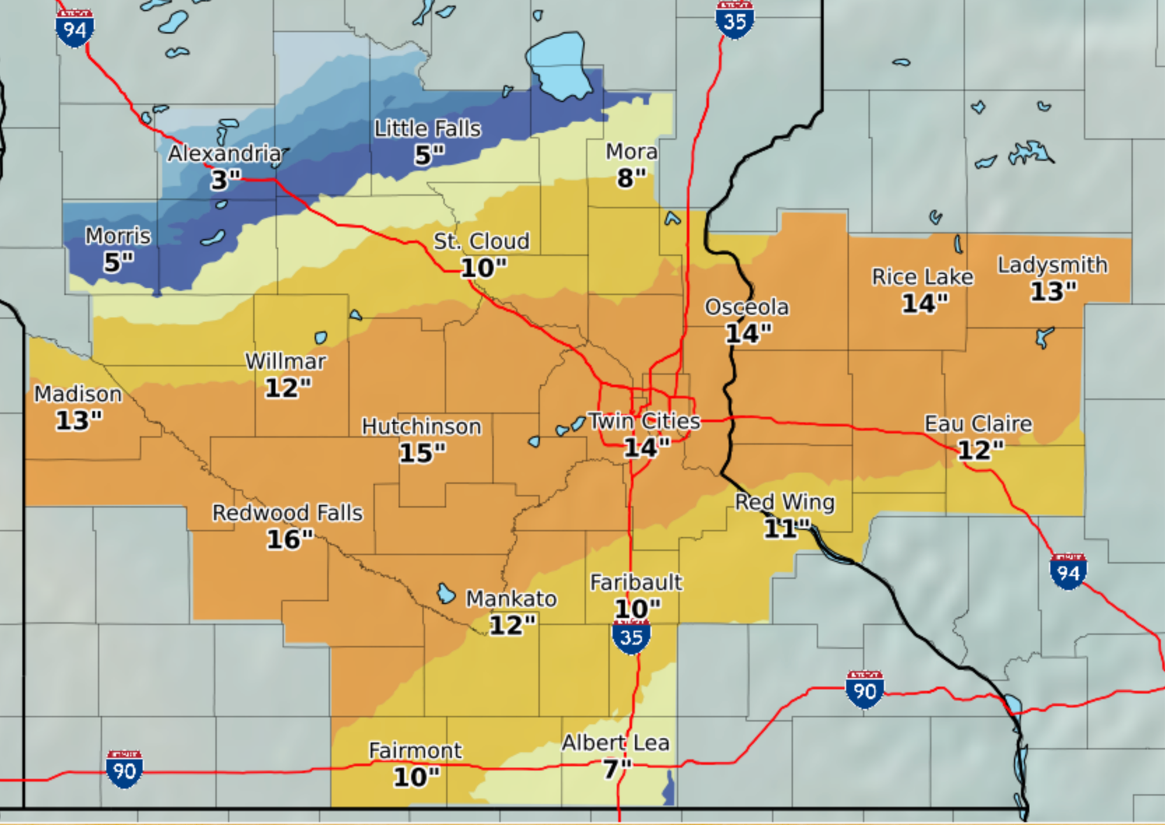
- Snow accumulation estimates for this weekend, according to the National Weather Service. Provided
The National Weather Service’s winter weather watch for Albert Lea has worsened to a winter weather warning.
The warning will be in effect from 1 a.m. Saturday to 1 a.m. Sunday.
Heavy mixed precipitation is expected with total snow accumulations of 5 to 8 inches, with localized amounts up to 12 inches, and ice accumulations of one tenth to one quarter of an inch.
A blizzard warning is in effect tonight through Saturday evening for west central and south central Minnesota, and the storm warning is in effect for most of east central Minnesota, some of south central Minnesota and all of west central Wisconsin.
According to the National Weather Service, showers and thunderstorms are expected to continue this morning and continue for much of the day as temperatures remain in the mid-30s in central Minnesota to the lower 40s along the Minnesota and Iowa border.
Colder air will begin to move into central Minnesota this afternoon and evening, changing the precipitation to snow.
The best chance for whiteouts will be late Friday night across the western central part of the state.
Rain will turn to a wintry mix of freezing rain, sleet and snow across south central and east central Minnesota, before changing to all snow by Saturday morning.
Total snow accumulations of 8 to 15 inches are expected from west central and southwest Minnesota to east central Minnesota and northern Wisconsin, with totals nearing 18 inches in southwest Minnesota.
People should plan on difficult travel conditions. Tree branches could fall, and winds gusting as high as 45 mph could cause areas of blowing and drifting snow.
Look to the Tribune for more information as it arises.
The latest road conditions can be found at www.511mn.org.
More Featured News


-
Construction Updates
-
-