Storm to bring a mix of precipitation
Published 5:42 am Thursday, April 12, 2018
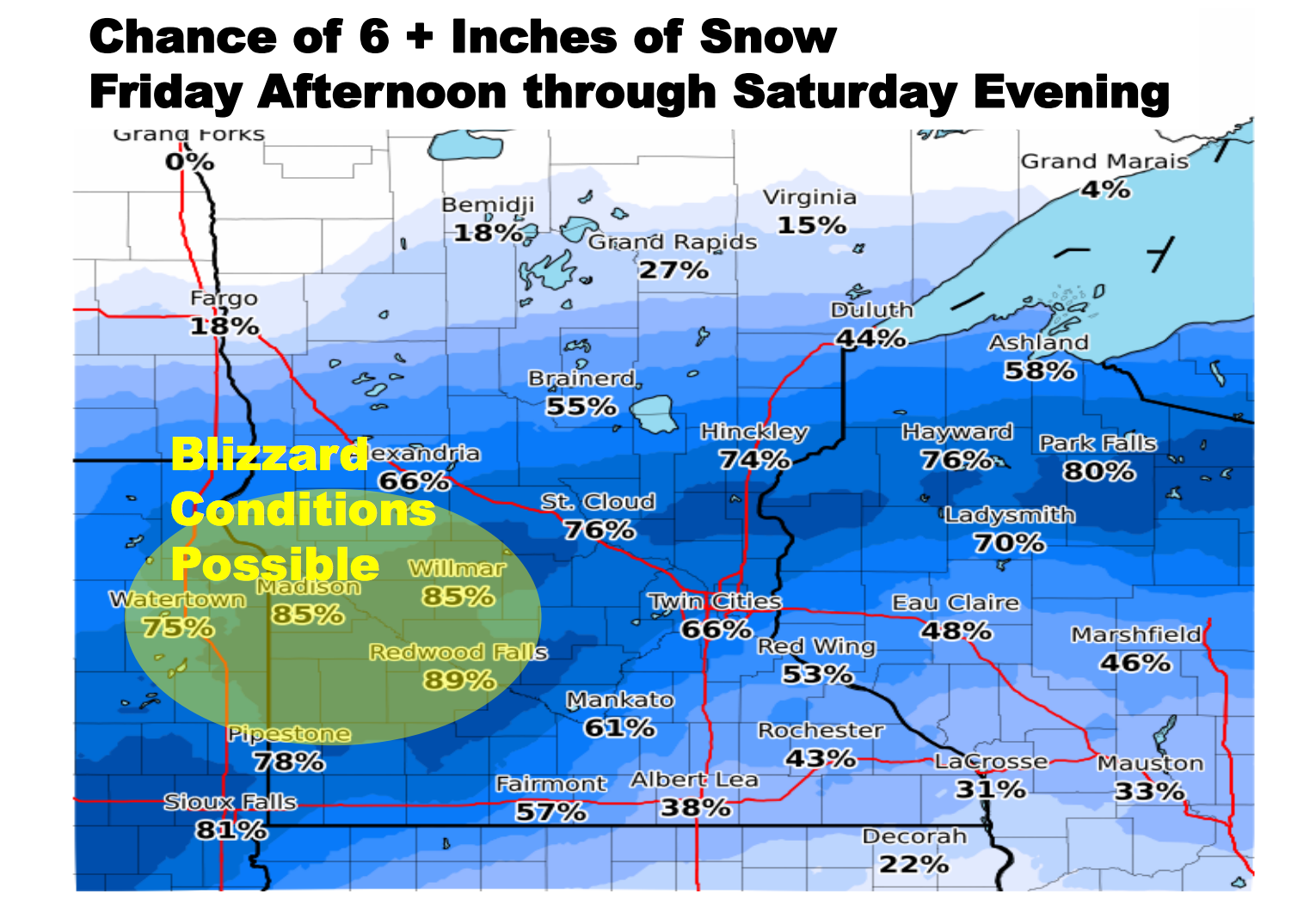
- Albert Lea is expected to receive 2 to 4 inches of snow accumulation and up to one tenth of an inch of ice accumulation. Provided
West, southwest parts of state could receive 10 to 15 inches
A major winter storm is expected to move into the area Friday, bringing with it possible freezing rain, snow and blizzard conditions.
Albert Lea is expected to be under a winter weather watch from late Friday night through late Saturday night, according to the National Weather Service.
The Weather Service forecasts heavy mixed precipitation, with total snow accumulations of 4 to 8 inches and ice accumulations of one tenth to two tenths of an inch in the area.
The weather agency states rain and thunderstorms were expected to develop late Thursday night and continue for much of the day Friday as temperatures remain in the lower 40s along the Minnesota-Iowa border.
Colder air will begin to move into central Minnesota Friday afternoon and evening, changing the precipitation to snow across central and western Minnesota. In addition to the heavy snow, strong winds gusting between 40 to 50 mph will bring the possibility of blizzard conditions to west central Minnesota.
The rain is expected to turn into a wintry mix of freezing rain, sleet and snow across south central Minnesota Friday evening, before changing to all snow Saturday morning.
Total snow accumulations of 10 to 15 inches are expected from west central and southwest Minnesota to east central Minnesota and northern Wisconsin, with totals nearing 18 inches possible.
People should plan on difficult travel conditions, and tree branches could fall.
Winds gusting as high as 45 mph could cause patchy blowing and drifting snow.
The Weather Service states widespread 1 to 2 inches of precipitation could cause flooding issues, especially in areas where mostly rain is expected across southern Minnesota into western and southern Wisconsin.
More Featured News


-
Construction Updates
-
-