Snow likely before arctic temps move into region
Published 6:48 am Wednesday, February 3, 2021
- Image courtesy National Weather Service
|
Getting your Trinity Audio player ready...
|
The National Weather Service is calling for snow and blowing snow on Thursday before a strong cold front moves into the area, bringing dangerously cold wind chills for the weekend.
The weather agency states rain, snow and possibly freezing rain will develop late Wednesday night mostly across southern and eastern Minnesota into western Wisconsin.
A cold front will pass through Thursday morning with temperatures falling from the low to mid-30s to the teens in the afternoon.
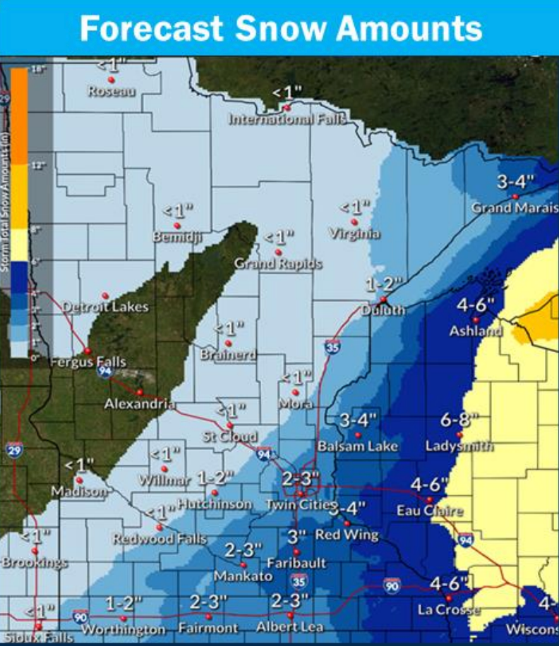
Precipitation is expected to become widespread and turn to snow early Thursday morning. Total snow accumulations of 2 to 3 inches of snow are possible across south-central Minnesota into western Wisconsin.
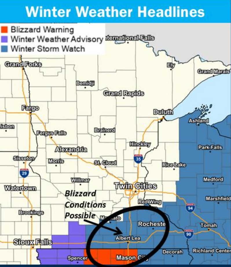
Image courtesy National Weather Service
Strong northwest winds with gusts of 35 to 45 mph are expected through early Thursday evening, bringing the potential for blizzard conditions. Much of the risk will depend on how much snow falls.
The Weather Service has issued a winter storm watch from Thursday morning through Thursday evening. A blizzard warning has been issued south of Albert Lea in Iowa.
People should plan on slippery road conditions and reduced visibility.
Temperatures Thursday night and Friday will fall into the single digits. Temperatures will fall below zero Friday night.
On Saturday, wind chills near 30 degrees below zero are expected in Albert Lea.