Update: Tornado watch issued; severe weather possible Thursday
Published 8:52 am Thursday, May 19, 2022
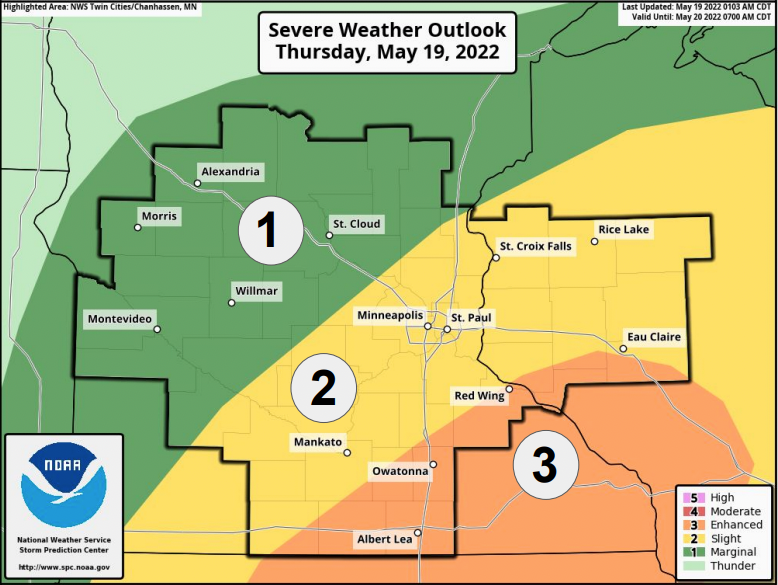
- Image courtesy National Weather Service
|
Getting your Trinity Audio player ready...
|
Update:
The National Weather Service has issued a tornado watch through 10 p.m. for the following counties:
- Blue Earth
- Faribault
- Freeborn
- Mower
- Steele
- Waseca

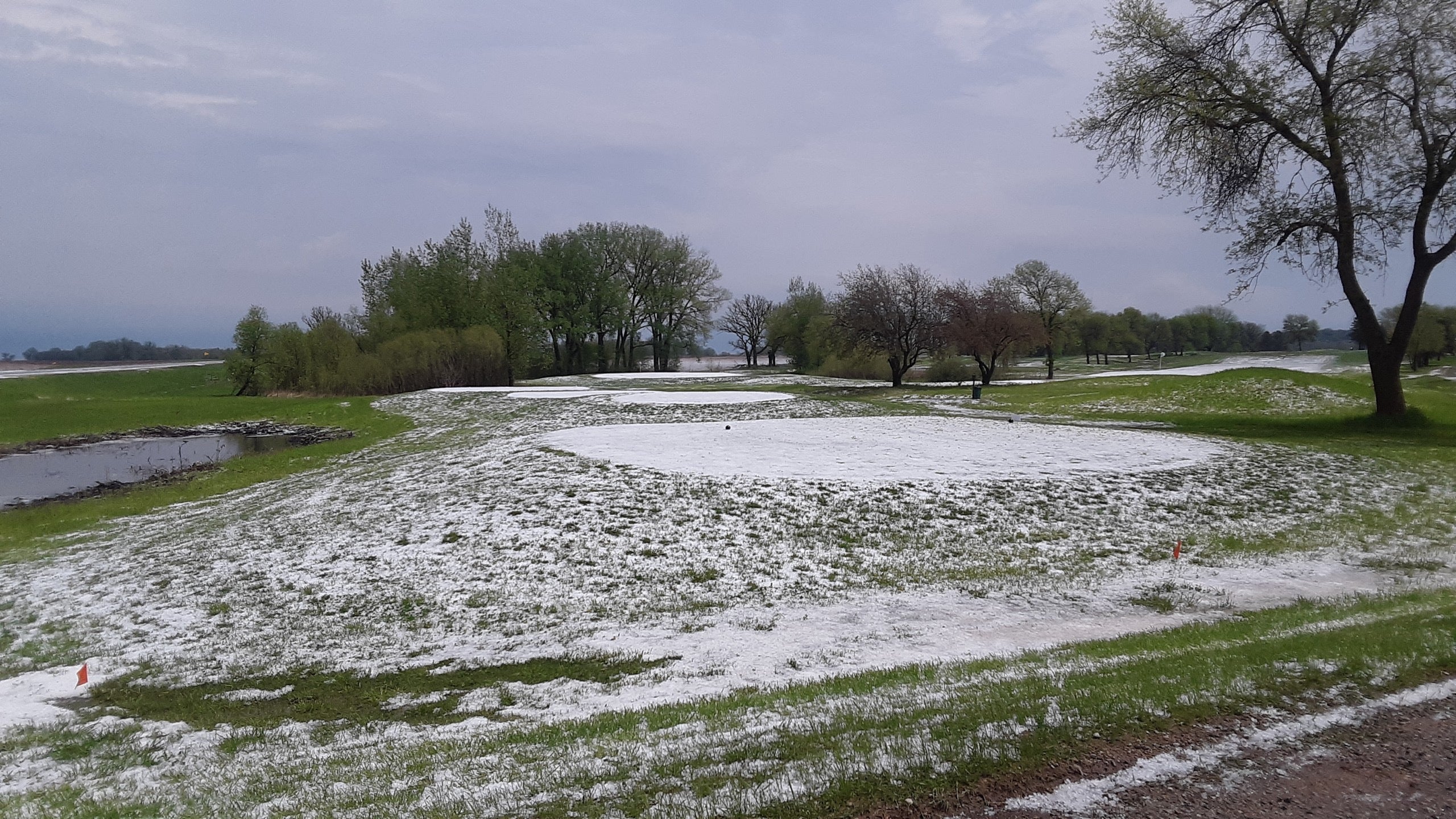
Hail covers the ground in Emmons earlier today as a storm system moved through. Reports of hail as large as golf ball size have been reported in Emmons, Glenville and Twin Lakes. Photo courtesy Tom Jones
Original story:
Severe weather is a threat this afternoon and evening as thunderstorms are expected to move into the area.
According to the National Weather Service, the main severe threat is hail, though damaging wind and hail are also possible.
The best chance for tornadoes will be in south to southeastern Minnesota, with the risk diminishing as storms head into Wisconsin. The initial thunderstorms likely pose the greatest risk for hail and tornadoes.
The best chance for severe wind will also be in south to southeastern Minnesota, as well as western Wisconsin, once storms begun to cluster during the evening.
Albert Lea is listed at an enhanced risk of severe weather — a three out of five on the risk scale — along with much of the surrounding area.
More News


-
Construction Updates
-
-