Dangerous storm expected to move in mid-week
Published 8:00 pm Monday, December 19, 2022
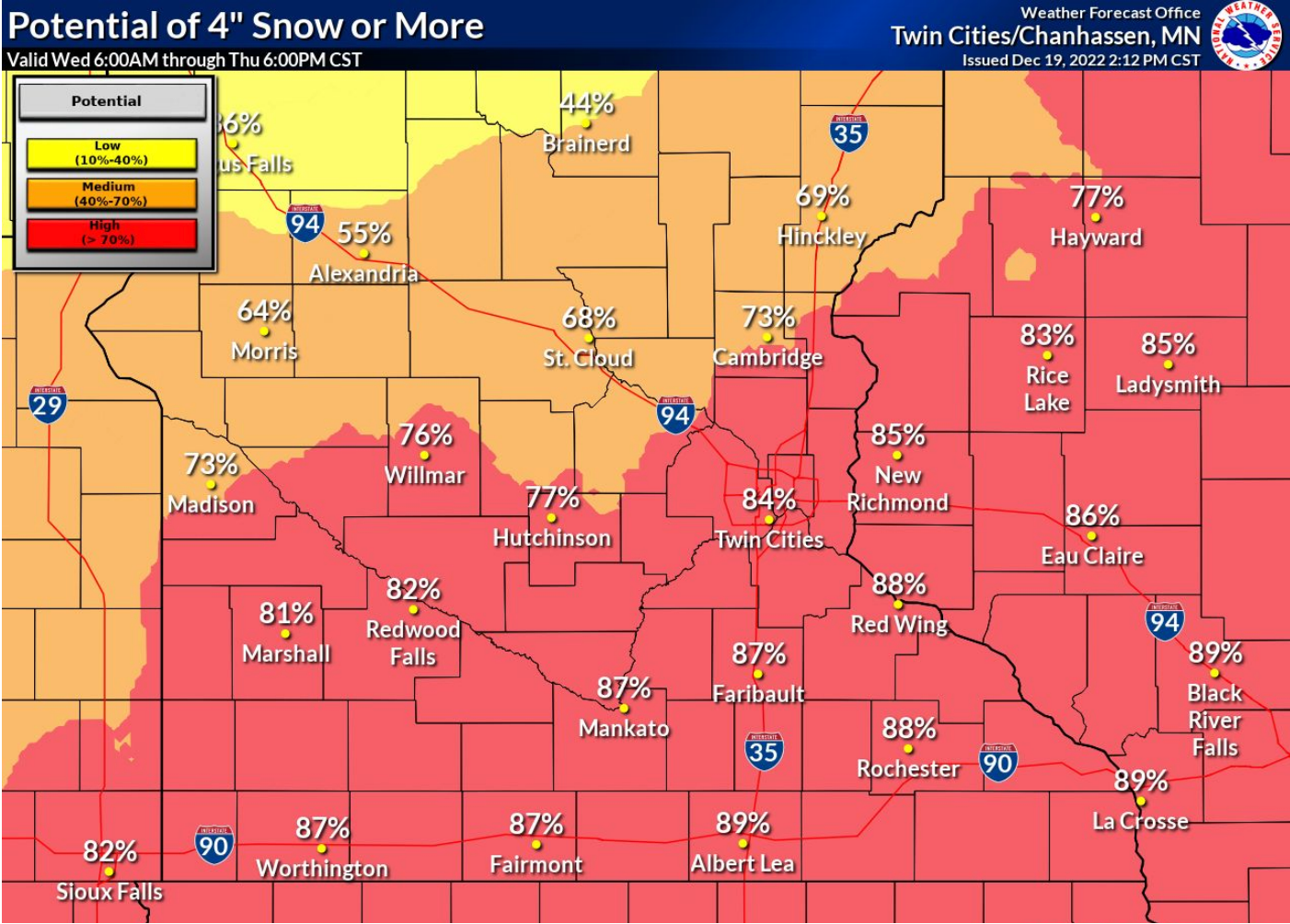
- Image courtesy National Weather Service
|
Getting your Trinity Audio player ready...
|
Blizzard conditions and dangerously cold air are expected to move into the area mid-week, bringing several inches of snow and hazardous driving conditions.
The National Weather Service has issued a winter storm watch from Wednesday afternoon through late Friday night for all of central and southern Minnesota and west central Wisconsin.
A wind chill watch is also in effect from Thursday through Saturday morning as wind chills dip to between 30 below and and 45 below zero.
The weather agency stated total snow accumulation of 6 to 10 inches is possible from Wednesday through early Thursday before strong northwest winds gust as high as 55 mph and dangerously cold air surges Thursday through Saturday morning.
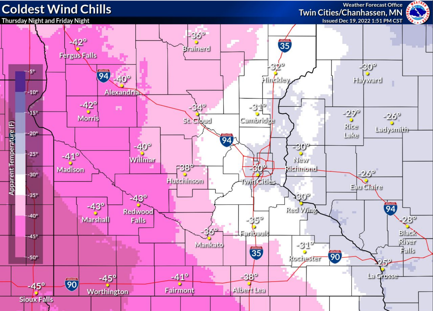
Image courtesy National Weather Service
Whiteout conditions are expected as driving will become difficult or impossible.
The Weather Service warns that the conditions could be life-threatening if people are stranded. It advised people to adjust travel plans for late this week.
Dangerously cold wind chills could cause frostbite on exposed skin in as little as 10 minutes.
Strong winds combined with heavy snow on trees could also result in tree damage and power outages as temperatures drop below zero.
More News

SportsPlus
How to Watch MLB Baseball on Friday, July 26: TV Channel, Live Streaming, Start Times
Friday’s MLB slate includes the Cleveland Guardians playing the Philadelphia Phillies at Citizens Bank Park. Wager on today’s…
How to Watch the Twins vs. Tigers Game: Streaming & TV Channel Info for July 26
A pair of hot hitters, Carlos Santana and Riley Greene, will try to keep it going when the…
Twins vs. Tigers: Betting Preview for July 26
When the Minnesota Twins (56-45) and Detroit Tigers (51-53) match up at Comerica Park on Friday, July 26,…
Twins vs. Tigers Series Preview: TV Channel, Live Streams, Starting Pitchers and Game Info – July 26-28
The upcoming three-game series that pits the visiting Detroit Tigers versus the Minnesota Twins begins on Friday, July…
Minnesota Vikings vs. Green Bay Packers Week 17 Tickets Available – Sunday, December 29 at U.S. Bank Stadium
The Minnesota Vikings (0-0) and the Green Bay Packers (0-0) — two NFC North combatants — meet on…
-
Construction Updates
-
-